Loading...
Follow us:

Dayara Bugyal

TREK DETAILS

START: Dayara Bugyal TO END: Dehradun To Dehradun

celender

4N - 5D

Download Itinerary

celender

12,100 ft

Download Itineraryn

celender

21 Km

Download Itinerary

SUB TOTTAL RS. 6500/-

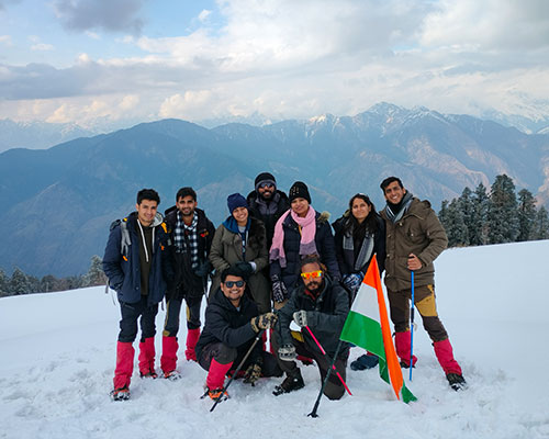
The Most Beautifully Landscaped Meadow of our Country

Dayara Bugyal is a beloved trek among Indiahikes’ seasoned trekkers. It offers stunning beauty year-round: lush forests in spring, vibrant green meadows in summer, orange hues in autumn, and a serene snowscape in winter. The meticulously landscaped meadows, set against the backdrop of the majestic Gangotri mountain range, make this trek a favorite even for beginners.

Situated at an altitude of over 10,000 feet, Dayara Bugyal provides breathtaking views of the Greater Himalayas, with peaks like Bandarpunch, Kala Nag, Srikanth, Jaonli, and Draupadi Ka Danda seemingly within reach. Trekkers often spend hours marveling at the sunset over these mountains.

During summer, the meadow blooms with colorful alpine flowers, including Himalayan blue poppies, daisies, and primroses. Surrounding the meadow are enchanting oak and rhododendron forests, adding contrast to the snow-covered peaks. The trek is also home to various bird species, including the Himalayan monal, Uttarakhand’s state bird.

doom

Journey to Natural Beauty: Dayara Bugyal Trek

  1. Raithal, the Dayara Bugyal trek base camp, is a 9-hour drive from Dehradun.
  2. The route takes you through picturesque forests and Mussoorie, a renowned hill station.
  3. A viewpoint called Tingling Point offers breathtaking views of the Garhwal Himalayas, including Swargarohini, Mt. Bandarpoonch, Gangotri Peaks, and more, on clear days.
  4. Uttarkashi is the largest town on the way before heading to Bhatwari.
  5. Approaching Raithal, you’ll witness stunning sunset colors over peaks like Mt. Bandarpoonch, Mt. Srikanth, Mt. Jaunli, and Draupadi ka Danda.
doom

Traverse Nature’s Path: Raithal to Gui on the Dayara Bugyal Trek

  1. At Raithal, enjoy views of Mt. Srikanth, Gangotri 1, 2, and 3, and other distant peaks.
  2. As you ascend towards Gui, you’ll notice the Gui campsite visible from Raithal.
  3. The trail gradually ascends, passing through village fields initially.
  4. After a water point with a hand pump, enter a rich forest of green and brown oaks and rhododendron. Unlike other areas, there are no pine trees in this forest.
  5. Gui campsite is a small clearing surrounded by forests, with village huts used by summer villagers and a forest department hut nearby.
doom

Trek distance: 2.5 km | Trek Duration: 3 hours | Altitude gain: 9,630 ft to 10,515 ft

  1. The day’s trek continues from Gui towards Dayara, revealing hidden mountain views.
  2. It’s a short day (3 km) with gradual ascents and flat sections.
  3. As you depart Gui, you climb to Gui Thatch, a meadow with Chania huts, a pond, and Forest Department igloo-shaped structures.
  4. Gui Thatch offers incredible views of the Gangotri range, including Shrikanth, Gangotri I, II, III, Jaonli, and Bandarpoonch.
  5. The next half-kilometer is a relaxed walk through beautiful rhododendron forest.
  6. You start ascending again, crossing streams, and reaching a rain shelter rest point.
  7. Chilapada is 20 minutes from the rain shelter, accessed via a broken trail.
doom

Exploration day at Dayara Bugyal

  1. Chilapada is a short distance from the start of Dayara Bugyal, allowing ample time to explore the vast meadows.
  2. After ascending through the forest, you reach the meadow’s edge with a partial view.
  3. Chania huts can be spotted, and the trail follows the meadow’s edge with stunning views of Bandar Poonch and Kala Nag.
  4. Photo-worthy: Early morning at Dayara Bugyal offers breathtaking views of undulating meadows under different sunlights.
  5. In spring, the meadows bloom with yellow, violet, and white flowers, while winter blankets them in powdery snow.
  6. Explore Dayara meadows for a few hours before returning to Chania huts. The trail to Nayata descends below the huts, entering a well-laid-out wooded path. After about 45 minutes, you’ll reach Nayata.
doom

Trek distance: 4 km | Trek Duration: 4-5 hours | Altitude loss: 9,186 ft to 7,142 ft

  1. Start trekking by 9 am for a 4-hour journey to Raithal from Nayata.
  2. Follow the same main trail from Dayara, descending through dense forest.
  3. After 15 minutes, pass the familiar rain shelter and continue downhill.
  4. An hour later, reach a grassy clearing with a water source for a brief rest.
  5. Complete the final descent to Raithal, marked by the Raithal arch.
  6. GMVN is half a kilometer down the paved road, concluding your Dayara Bugyal trek.
doom

185 Km trek, Trek Duration: 8 Hours

  1. Depart from Raithal after breakfast.
  2. Embark on a scenic drive back to Dehradun.
  3. Anticipate reaching Dehradun around 7.00 PM on the same day.

Our Newsletter

As we step into this new month, we’re excited to share the incredible initiatives and events happening within our organization. Your support and involvement are what make our community thrive, and we can’t wait to highlight the positive changes we’re all creating together.

whatsapp chat